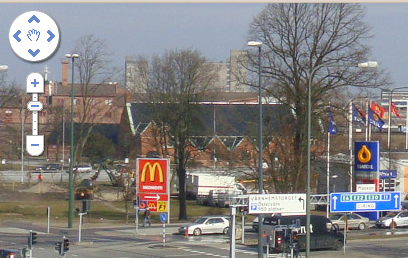
The Google Maps API can be used for other things than maps. This is an example of using Google Maps to show large images.
The tiles were created with this python script:
#!/usr/bin/env python

import sys, math
import cairo

if __name__ == '__main__':
    master = cairo.ImageSurface.create_from_png(sys.argv[1])
    dest_width = int(sys.argv[2]) if len(sys.argv) > 2 else 256
    dest_height = int(sys.argv[3]) if len(sys.argv) > 3 else 256
    min_zoom = int(sys.argv[4]) if len(sys.argv) > 4 else 0
    max_zoom = int(sys.argv[5]) if len(sys.argv) > 5 else 0

    vert_tiles = (master.get_width() + dest_width-1) / dest_width
    horiz_tiles = (master.get_height() + dest_height-1) / dest_height

    most_tiles = max(vert_tiles, horiz_tiles)
    base_zoom = int(math.ceil(math.log(most_tiles) / math.log(2)))

    if max_zoom == 0:
        print('Image dimensions: %ux%u' % (master.get_width(), master.get_height()))
        print('Tile dimensions: %ux%u' % (dest_width, dest_height))
        print('Tiles in base zoom: %ux%u' % (vert_tiles, horiz_tiles))
        print('Base zoom level: %u' % base_zoom)
        print('Run with min_zoom and max_zoom parameters to produce tiles.')
        sys.exit(0)

    for z in range(min_zoom, max_zoom+1):
        scale = 2**(z - base_zoom)

        src_width = dest_width * 2**(base_zoom - z)
        src_height = dest_height * 2**(base_zoom - z)

        vert_tiles = int(math.floor((master.get_width() + src_width-1) / src_width))
        horiz_tiles = int(math.floor((master.get_height() + src_height-1) / src_height))
        print('Zoom level %u (tiles: %ux%u)' % (z, vert_tiles, horiz_tiles))

        for y in range(horiz_tiles):
            for x in range(vert_tiles):
                tile = cairo.ImageSurface(cairo.FORMAT_ARGB32, dest_width, dest_height)
                ctx = cairo.Context(tile)

                pattern = cairo.SurfacePattern(master)
                pattern.set_filter(cairo.FILTER_BEST)
                pattern.set_matrix(cairo.Matrix(xx=1.0/scale,
                                                yy=1.0/scale,
                                                x0=x*dest_width/scale,
                                                y0=y*dest_height/scale))

                ctx.set_source(pattern)
                ctx.rectangle(0, 0, dest_width, dest_height)
                ctx.fill()

                print('+ tile-%u-%ux%u.png' % (z, x, y))
                tile.write_to_png('tile-%u-%ux%u.png' % (z, x, y))
It will convert a PNG image to PNG tiles. The script depends on pycairo to do the cutting and scaling of the images. This example converts master.png to tiles of size 256x256 with 1 being the minimum zoom level and 4 being the maximum zoom:
$ pngmaptiler.py master.png 256 256 1 4
